With Chan Krieger Sieniewicz’s (CKS) official land-use report for the soon-to-be-vacant Interstate 195 land in the Jewelry District and Fox Point in its final draft, two universities have started a legislative push to secure some of the land.
Much of the plan for the west side of the Providence River is based on restoring the Jewelry District’s street grid, which had been disrupted by the construction of I-195 in the early 1950s. Johnson & Wales University, for example, is seeking to buy two parcels totaling 2.86 acres and CKS notes in its final draft that selling those parcels to the university would be a “reintroducing [of] the historic street pattern.” The CKS draft lists selling those parcels for institutional use as one of several options.
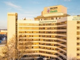
But the physical layout of the streets is almost a secondary concern, according to Richard Spies, Brown University executive vice president for planning and senior adviser to the president. Brown is seeking three parcels totaling 4.25 acres in the Jewelry District. The CKS draft lists the university’s proposed use as the only option for two of those parcels.
Spies last week said Brown and JWU are pushing to be the first into the new land because they would act as anchors for a new “knowledge-based” district.
“The idea is to establish early the presence of two substantial institutions as anchor tenants … as part of an economic strategy,” Spies said.
Brown hasn’t yet formalized its plans for the property it seeks, but owns several other adjacent properties.
But for nearly a decade JWU has been planning to add the few parcels south of its current holdings as part of a master plan, JWU Senior Vice President of Facilities Management Merlin DeConti said last week.
“Really, what we want to build is a hospitality college on the western part of” one of the two parcels JWU is seeking, DeConti said, “and a couple of dormitories, which would fall mostly on our own land but also on a little bit of [the smaller parcel we’re seeking.]”
The first parcel that JWU hopes to get its hands on would likely be available for purchase within a year – and maybe as soon as the end of 2009, according to the CKS final draft report.
The parcels that the universities are seeking total about 36 percent of the 19.79 acres set to be opened up on the west side of the river, according to CKS’ final report. Another 6.54 acres will be cleared on the city’s East Side.
Brown and JWU have backed a bill that would allow for the fair-market value sale of the property they seek from the R.I. Department of Transportation.
DeConti said the universities and the city have agreed that neither school will be allowed to buy the land until they strike a deal with the city for voluntary payments in lieu of taxes. That’s because the land – seen as some of the most valuable to open in Providence in decades – would likely be taken off the city’s tax roles if JWU and Brown buy it for institutional purposes.
A spokesman for the Providence Department of Planning & Development did not immediately return a call seeking comment.
The March final draft of the report – the “Rhode Island Interstate I-195 Relocation Surplus Land: Redevelopment and Marketing Analysis” – is a dense, 168-page document that details the current conditions of each of the parcels and suggests future use. Although originally scheduled for “late” 2008 release, the final report is now not expected to be released until July. A spokesman from the R.I. Economic Development Corporation said last week that EDC will not comment on the report until it is officially released. A spokesman at the R.I. Department of Transportation referred all inquires to RIEDC. A spokesman for CKS did not immediately return a call seeking comment.
But at least one group that’s taken a look at the draft report took issue with what it suggests as a “highest and best” use.
For the southeastern-most property that could be developed – a 1.37-acre waterfront parcel where the former Shooters nightclub building is – the final draft of the report suggests that a 72,000-square-foot residential building, with 60 units and 24,000 square feet of parking, would be the best.
Head of the Bay Gateway, which has been pushing for public space on that site since DOT announced that it would be sold, insists the value of that parcel as a possible public draw to the area has been underestimated.
And for much of the property on the east side of the river, the draft report calls for residential development. On five parcels that total 4.42 acres – a few of which front on South Main Street – CKS recommends that developers build as many as 41 town houses and 288 residential units. The recommendations call for buildings between three and six stories tall with commercial and retail space along the east side of South Main Street.
There’s also land put aside for waterfront public space on the west side of the river. As expected, a public park is planned for a 5.9 acre parcel called “P4,” where the I-195 bridge across the river now starts. •