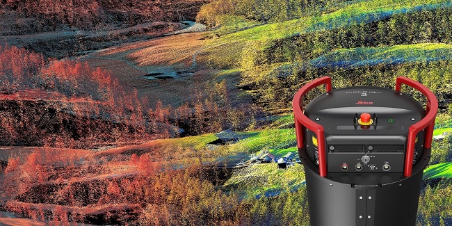
PROVIDENCE – Leica Geosystems, a brand of the geosystems division of Hexagon AB, based in Sweden but with its Hexagon Manufacturing Intelligence division headquartered in North Kingstown, has introduced its Leica TerrainMapper-2 for regional mapping projects.
The mapping tool integrates light detection and ranging to measure distances, or LiDAR, and image-capture technology in airborne sensors, letting its users collect more data per flight, according to Hexagon.
Rhode Island's Market Has Changed. Developers, Builders, Investors and Sellers Must Change With It.
By Emilio DiSpirito IV License Partner | Engel & Völkers Oceanside Leader | The DiSpirito…
Learn More
Upgraded technology allows for a reduction in system complexity and more efficiency, Leica said, allowing for easier installation into survey aircraft, as an additional equipment rack is not needed. The system’s design also makes way for a seamless upgrade to the Leica CityMapper-2 oblique imaging and LiDAR hybrid sensor, according to the manufacturer.
The TerrainMapper-2, said Leica, has cameras with unique mechanical forward-motion compensation to allow images to be captured in low light, so pilots can fly longer each day.
TerrainMapper-2 combines with the unified multi-sensor post-processing workflow, HxMap, to process large data sets at high speeds. This results in higher efficiency and productivity for customers, according to Leica. Faster ground processing is accomplished with edge computing and LiDAR data undergoing return extraction on the fly.
“With the recent release of the CityMapper-2 for urban areas, our customers also needed these same advanced imaging capabilities for regional LiDAR projects. With the TerrainMapper-2, we will now be able to support their needs for increased flexibility, scalability, accuracy and higher productivity,” said Ron Roth, Leica Geosystems product manager.
Susan Shalhoub is a PBN contributing writer.