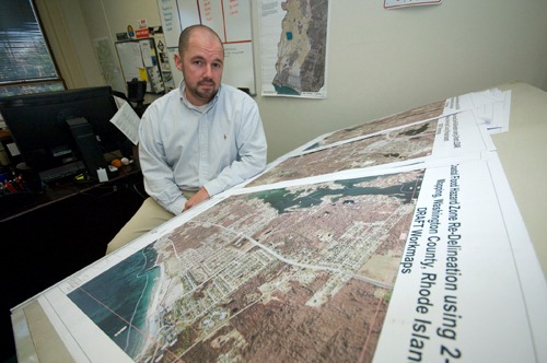
New floodplain maps delivered to local communities earlier this year by the federal government could hold costly implications for hundreds, if not thousands, of property owners in the Ocean State.
Early this year the Federal Emergency Management Agency (FEMA) started a months-long process to digitize floodplain maps that banks utilize to determine insurance policy requirements. And while relatively little new data is being added, the digitization of the maps for Washington, Kent and Newport counties clarifies the exact lots and buildings within the national floodplain by overlaying the floodplain with aerial photographs. Some communities have also overlaid the maps onto a geographic information system (GIS), allowing them to almost instantly analyze the lots within the floodplains.
Local planners say the refined maps could potentially lead lenders to require property owners that straddle the line or have been moved to higher-risk zones to take out flood insurance or pricier policies.
For those in areas more prone to flooding, insuring an oceanfront home can cost thousands of dollars a year. FEMA estimates that insuring an oceanfront home and its contents in Narragansett would cost up to $5,922 annually. Nationally, the average residential flood insurance policy is around $540 a year, FEMA said. Commercial rates vary widely depending on the facility and its contents.
Federally regulated lending institutions with mortgages secured by buildings in high flood-risk areas are required to carry flood insurance. Homeowners that decline to purchase insurance can see their banks force it upon them, normally at a higher rate than had the homeowner purchased it. FEMA defines high-risk areas as those having a one in 100 chance of flooding in any given year.
FEMA’s new maps also include zones where the chance of flooding is less than 1 percent annually, but those properties are generally not required to carry flood insurance. Still, town officials expect a lot of notices from banks and confusion as property owners seek insurance.
Parker said estimates show about 4,000 properties in Narragansett are within 500 feet of the floodplain border and that as many as 194 buildings of greater than 200 square feet could be added to the floodplain because of the redefined maps. An entire building is considered in the floodplain even if just a segment of the structure falls within it.
Statewide, potentially thousands of property owners face notification from lenders, said Michelle Burnett, floodplain manager for the R.I. Emergency Management Agency. Federal, state and local officials are racing to tell property owners of the changes before the maps become effective in April or September of next year, depending on the county.
“As soon as maps become effective then the onslaught of letters will probably follow,” Burnett said.
At least two Rhode Island banks – Webster Bank and Bank Newport – are tracking the mapping process and plan to notify homeowners who find themselves in the plain or a higher-risk zone, officials at the banks said.
David Mendelsohn, who is helping coordinate the map-modernization project for FEMA, said he is telling homeowners and business owners to review the draft maps available at their town or city hall and then speak with their insurance companies. For many people, taking out a flood-insurance policy now will lock-in rates defined under the present maps.
“The worst thing you want to do is wait until after the maps become effective,” said Mendelsohn, who works at FEMA’s New England office, because you could then face unexpected costs for being included in a higher-risk zone.
John Kaull, vice president at the OceanPoint Insurance Agency Middletown office, said other property owners in floodplains who are not required to carry flood insurance (because they don’t have a mortgage) could be in for an even bigger surprise if they try to sell their home.
“Once you have that situation, in theory, you can’t really sell the property” without the flood insurance, Kaull said.
So communities are moving to let residents know, with some officials putting the maps online, others sending mailings and some hanging up notices and maps in city or town halls.
There are 20 communities in the three affected counties that are getting updated floodplain maps. Of those, Providence Business News spoke with local officials in 18 communities, most of which had not reviewed the maps carefully enough to say how the changes will affect their city or town.
In Westerly, however, planner Marilyn Shellman estimates hundreds of properties could be added to the plain. In Middletown, the boundary line moved slightly, and planner Ronald Wolanski expects about 15 properties to be added to the plain. South Kingstown and Hopkinton planners expect fewer than a handful of properties to be added. None of those four have looked at how many properties might no longer fall in the floodplain.
Denise Stetson, town planner in Richmond (which has not reviewed potential changes), said even making a comparison was challenging because of the antiquated original maps.
“Before … you couldn’t really tell if your house was in it,” Stetson said. “You had a white map with some blue lines on it and some shaded areas.”
Mendelsohn said some of the current maps in Rhode Island date back to 1980, if not earlier. And because they were done on a community level with little coordination, the floodplain is often inconsistent across municipalities. With the new maps that will change, because they are being done on the county level.
Once updated, communities must adopt the maps if they want their property owners to be able to qualify for disaster relief during times of declared disasters, or participate in the National Flood Insurance Program underwritten by FEMA.
Paige Bronk, director of planning, zoning, development and inspections in Newport, said the City Council was mulling the impact of adopting an ordinance that would update the maps and, along with them, modify development regulations in floodplains.
“I think if the ordinance went too far it could be detrimental to … construction and the cost of construction in those areas,” Bronk said.
Buildings outside the highest-risk zones also face potentially high costs as lenders demand they carry insurance policies. Property owners can normally appeal a flood-insurance requirement through an internal system, but that often requires hiring a surveyor to identify the elevations on the structures and the exact floodplain boundaries. That can cost about $600 for a typical property, said Jim Reddington, a surveyor at Alpha Associates in East Greenwich.
Alternatively, property owners can hire a surveyor for about $1,350 and petition FEMA directly to remove their property from the map entirely. If the survey shows a flood risk below FEMA’s threshold, the agency will remove the property.
FEMA has been updating the maps under a multiyear program that has its origins in the National Flood Insurance Reform Act of 1994. In federal budgets spanning 2003 to 2006, Congress provided money to carry out updating the maps, originally put together for the National Flood Insurance Program.
New maps for Bristol County were adopted in 2006. Providence County finalized in March 2009. Burnett said those maps caused relatively little impact, although about 200 property owners in Woonsocket found themselves in a new floodplain designation because the Woonsocket Levy System lost its U.S. Army Corps of Engineers accreditation, Burnett said. •