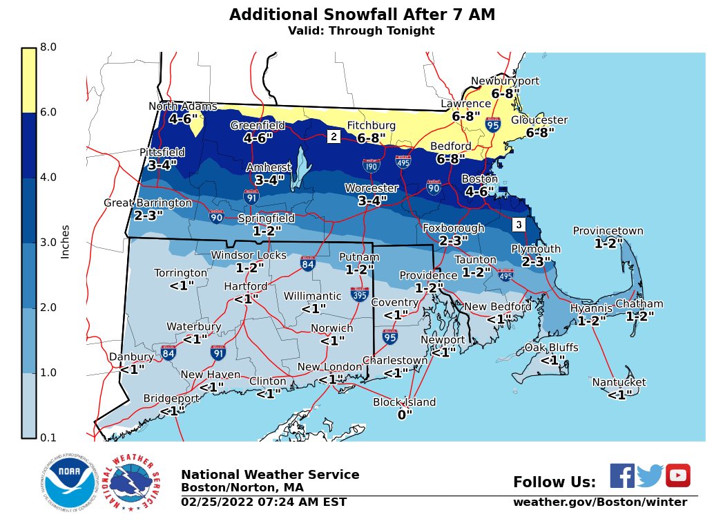
PROVIDENCE – Snow transitioned to a wintry mix across Rhode Island Friday, bringing a messy morning commute but less snow the rest of the day than forecast.
Rhode Island received 1 to 2.5 inches of snow before the storm transitioned to a mix of sleet and freezing rain around 7 a.m., the National Weather Service reported.
Your Business Has Gone Global. Has Your Insurance?
A decade ago, “doing business internationally” was mostly a large-company concern. Today, a manufacturer in…
Learn More
Providence recorded snowfall of 2.5 inches before the wintry mix arrived, according to the National Weather Service. North Smithfield saw 2.3 inches and Cumberland had 2 inches.
The band of snow, which was expected to dump as much as 8 inches in the Providence area, moved farther north with heavier snowfall north of the Massachusetts Turnpike Friday, the agency reported.
At 2:30 p.m. Friday, The National Weather Service reported Johnstown received 3 inches of snow, while Warwick and Coventry had both received 2.5 inches. Providence got an additional 1.4 inches of snow for a total of 3.4 inches.
A winter storm warning remains in effect through Friday night.
(SUBS penultimate paragraph with NWS update.)