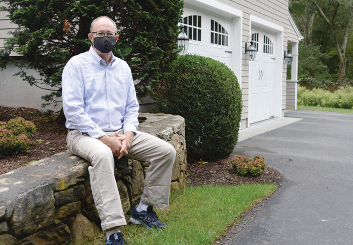
Mark A. Male’s South Kingstown home is at minimal risk of flooding, at least according to the Federal Emergency Management Agency’s flood plain maps.
Even though he’s not in a designated “special flood hazard area” for which flood insurance would be required, Male pays for it anyway, forking over a premium that now runs in excess of $500 annually.
It’s in part a matter of principle; as executive vice president for Independent Insurance Agents of Rhode Island, Male feels compelled to follow the advice he gives to homeowners on the value of insurance coverage. But he also recognizes that risk his home faces may be greater than FEMA’s maps suggest.
Indeed, a report released in June by Brooklyn, N.Y.-based nonprofit research group First Street Foundation found that 14.6 million more properties across the country were at risk for a 100-year flood than indicated by FEMA. In Rhode Island, an additional 9,000 properties faced “substantial flooding risk” – defined by FEMA as a 1% annual risk of flood – beyond the 23,900 properties recognized with the same risk in FEMA’s 2020 maps.
Jeremy Porter, director of research and development for First Street Foundation, said the report and mapping tool take into account the impact of direct rainfall from extreme rain storms, proximity to smaller rivers and tributaries, and projections for future risk based on climate change.
‘People look at it as a discretionary expense.’
MARK A. MALE, Independent Insurance Agents of Rhode Island executive vice president
FEMA’s maps, on the other hand, recognize only historical flooding and focus primarily on major flood plains and properties near significant bodies of water, Porter said.
Kerry Bogdan, risk analysis branch chief for FEMA’s Region 1, which includes Rhode Island, defended the agency’s maps as based upon the best available science and subject to a rigorous review process by outside experts. However, the agency is also in the midst of overhauling its risk rating and corresponding insurance prices through its National Flood Insurance Program, with a new “Risk Rating 2.0” system set to debut in October 2021. What that means for individual properties’ risk rating and insurance costs remains unclear.
In the meantime, Porter hoped the analysis provided by First Street Foundation would inform and encourage homeowners and local municipalities to take precautions, including potentially purchasing flood insurance.
But whether any map or risk assessment will be enough to motivate homeowners to purchase optional flood insurance remains unclear. Unless mandated – which occurs when homeowners take out a mortgage on a property in FEMA’s defined risk areas – Rhode Island property owners have been largely reluctant to consider this extra insurance coverage, said Male.
A major reason is cost, which has soared in recent years.
For low-risk properties such as Male’s house, homeowners can expect to pay around $500 for flood coverage, but higher-risk, coastal properties or those in designated flood plains could require as much as $10,000 a year, according to Joseph J. Padula, managing director of property and casualty insurance for The Hilb Group of New England LLC.
Even Male has questioned whether the expense is worth it, particularly since his home has never been hit with flooding.
“Sometimes, I think, ‘Do I really want to pay this thing?’ ” he said. “People look at it as a discretionary expense.”
And with purse strings tightened amid the ongoing economic crisis caused by COVID-19, Marti Longolucco, a certified insurance counselor with Mansfield Insurance Agency Inc. in Westerly, reported that some existing purchasers have opted not to renew their policies. Inquiries for new coverage from those not mandated to have it, meanwhile, are few and far between, she said.
A big part of the problem is a lack of awareness. Terms such as “100-year flood” are misinterpreted to mean that severe flooding will only happen once every 100 years, leading people to believe it’s worth rolling the dice and going without coverage.
That FEMA’s maps designate risk primarily based on existing flood plains doesn’t help.
“People will say, ‘I live on a hill, so I am safe,’ and they’re not thinking about inland flooding,” Longolucco said.
While insurance agents, including Padula and Longolucco, try to instill awareness of and education about the importance of flood insurance in their customers, the biggest motivator is not words but experience with uncovered flood damage.
After a series of heavy rain events in 2010 flooded many inland homes in Westerly, most of which did not have flood insurance coverage, Longolucco saw a surge of interest and purchases of optional insurance policies. Interest has waned since then without any significant flooding, she said.
But chances of future flooding are expected to increase amid rising sea levels and changing weather patterns, with a 9.3% bump in the number of Rhode Island properties at risk in the next 15 years, according to First Street’s report. Thirty years from now, at-risk properties will increase by 18.7%.
Despite this, Male said it is unlikely that flood insurance would ever be included in traditional homeowner insurance policies or mandated for all property owners.
“Insurance is based on the ability to look at loss experience and make projections,” he said. “On flood insurance, there’s no way to predict what the scope might be. It’s really difficult to get a price on it and work it into models – at least without consumers getting upset.”
Nancy Lavin is a PBN staff writer. Contact her at Lavin@PBN.com.


