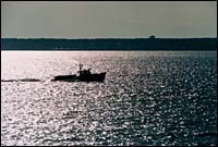
Narragansett Bay.
A project designed to avoid conflicts between aquaculturists and those in the fishing industry has resulted in a detailed map of Narragansett Bay.
Funded by the Rhode Island Coastal Resource Management Council (CRMC), and created by the University of Rhode Island, the map was the result of a series of meetings with different fishing organizations.
Rhode Island's Market Has Changed. Developers, Builders, Investors and Sellers Must Change With It.
By Emilio DiSpirito IV License Partner | Engel & Völkers Oceanside Leader | The DiSpirito…
Learn More
“What we asked the industry to do was color in the areas of the map that they use,” said David Elvs, head of aquaculture at CRMC. “Some parts of the fishing industry colored in the whole baywhat we really wanted them to do was fill out three gradation areas; ones that are critical to their industry, ones of medium importance, and areas of less or no importance.”
The goal, he said, was to provide an overall usage map of the bay that would be helpful when aquaculturists petitioned the CRMC for permission to lease locations in Narragansett Bay — many of which already are being used by others in the fishing industry.
“The mapping project is not intended to say you can’t go here or there,” he said. “What it’s intended to do is say if you want to work in this area then these are the groups that you need to work with to make it happen.”
Aquaculture in the state has grown almost 20 percent over the last year, according to Elvs. Though the total value of the industry to the state’s economy is only $200,000, Elvs said there is enough room in the bay to increase production.
“There is a lot of space out there but there are a number of different issues,” he said. “At the turn of the century one-third of the bay was leased for aquaculture. Though we are never going to go back to that because there are so many uses now, we can still improve.”
According to David Beutel, a professor of fish and veterinary science at URI who worked on the map, what makes finding aquaculture space so difficult, is that almost nothing else can be done in the area at the same time. For example, he said, if an aquaculturist in has an area of oyster cages on one acre they don’t want lobstermen setting traps there or a bottom trawler coming through — though they may not mind some recreational fishing in the area.
“When you have leased an area you need almost exclusive use of it,” he said. “For many other fisherman that is contentious.”
Still Elvs said there is enough room out there for everybody.
“If you go out on the bay on a summer’s day you see how many conflicting uses there are,” he said. “Aquaculture is never going to be a monster industry here, but it certainly has the potential to add to the economic bottom line and create decent paying jobs.”
Elvs is confident that cooperation is growing.
For example, he said a Middletown aquaculture company, which is reopening a former site, has agreed to clean up the water as well as allow lobsterman to continue setting their traps in the area.
“In instances like this no one loses anything, and the state gains an industry, an industry that uses the greatest natural resource we have,” he said. “It’s a win-win situation in my book.”
Beside promoting cooperation between fishing industry groups, both Beutel and Elvs said the map serves another important purpose – it’s a resource as to what’s happening in the bay.
“The value of this map is much greater than just fishing usages,” Elvs said. “This is putting down on the map what areas are important to us.”
Beutel said the map could also be helpful in extreme cases like an oil spill.
“This is a valuable piece of information because we have documented many uses of the bay,” he said. “So if there something like an oil spill we can see immediately by looking at the map what areas are affected.”
Though initial funding for the project has been exhausted, both Beutel and Elvs are hoping that another round of funding will provide them with the opportunity to continue documenting things like power lines, and moorings. In addition, Elvs said he would like the map to be posted on the Internet through the university’s Coastal Institute.
“We want this to be an information source about the water like we do for land,” he said. “It would be a boon for regulations, the fishing industry and other interest groups.”