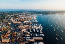
The state has entered into a purchase agreement to acquire Dyer Island, a 28-acre parcel off the coast of Portsmouth. As a result of the sale, the property will be added to the Narragansett Bay Estuarine Research Reserve.
“Dyer Island is a significant acquisition for the State of Rhode Island,” said Gov. Lincoln Almond. “The site hosts a unique habitat, and will be an asset for research activities in the Narragansett Bay reserve that are vital to the long-term health of the bay an our quality of life.”
Beyond Cash Donations: How New Forms of Giving Are Transforming Not-for-Profit Accounting
Evolving Funding Landscape for Not-for-Profits Not-for-profit organizations are being asked to do more with less,…
Learn More
The Department of Environmental Management (DEM) will purchase Dyer Island for $551,200 from Dyer Straits, Ltd. of Portsmouth.
“We are pleased to see that Dyer Island will be preserved in its natural state forever,” said David A. Rooney, commodore of Dyer Straits Ltd., and a Newport accountant.
The purchase is being accomplished with $251,200 from the state’s 1998 open space bond fund and $300,000 from an anticipated grant from the national Oceanic and Atmospheric Administration.
The island has a peak elevation of just 13 feet and is completely over-washed during hurricanes. Surrounded by shallow water, the island is vegetated with shrubs and contains one of the very few unditched salt marshes in Narragansett Bay. The island is also one of the very few sites in the state that is home to nesting oystercatchers, one of the rarest shorebirds in Rhode Island.
According to Roger Green, DEM’s manager of the Narragansett Bay reserve, Dyer Island will be open to boaters after the purchase is completed in September, but the parcel will remain undeveloped and will be used principally for research.
“The pristine nature of the saltmarsh complex on the island makes it extremely valuable as a reference site as the state moves forward with salt marsh restoration projects in other coastal areas,” he said. “The acquisition and incorporation of Dyer Island into the reserve promises to enhance our ability to protect and understand the ecology of Narragansett Bay.”
The Narragansett Bay National Estuarine Research Reserve currently spans 4,259 acres including more than 60 percent of Prudence Island, all of Hope Island, and all of the Patience Island. It features more than 17 miles of shoreline, including extensive saltmarshes, wooded swamps, and a kettle hole pond. The reserve manages approximately 2,353 acres of upland habitats: fields, decidous woods, evergreen woods, brushland, and a portion of Prudence Island’s unique upland “desert’ habitat.
The Narragansett Bay reserve is one of the national systems of 25 estuarine reserves protecting more than one million acres of upland, freshwater, wetland, salt marshes, intertidal areas, and subtidal areas.
The Narragansett Bay reserve is also a participant in a national system-wide water quality and meteorological monitoring program. This provides long-term specific data on the status and trends of environmental indices at all 25 reserves, nationwide. This data is collected and stored electronically every 30 minutes.